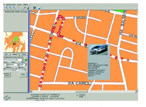
New SIS-MAP Client
 The SIS-MAP Client is developed for operational units that need to constantly know the position of each radio user in the area. It is a powerful tool based on NAVTEQTM vector cartography. The SIS-MAP imports images from any standard type, and gives the operator and radio users datailed site information, which is placed over the main cartography. The database contains a complete roadmap, topography of every municipality, addresses, etc. The SIS-MAP also includes a POI (Point of Interest) distance computing tool.

